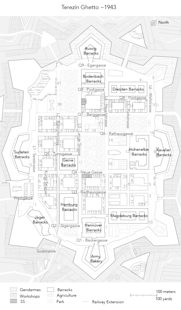
Map 1: Theresienstadt ghetto, ca 1943. Copyright Albane Duvillier.
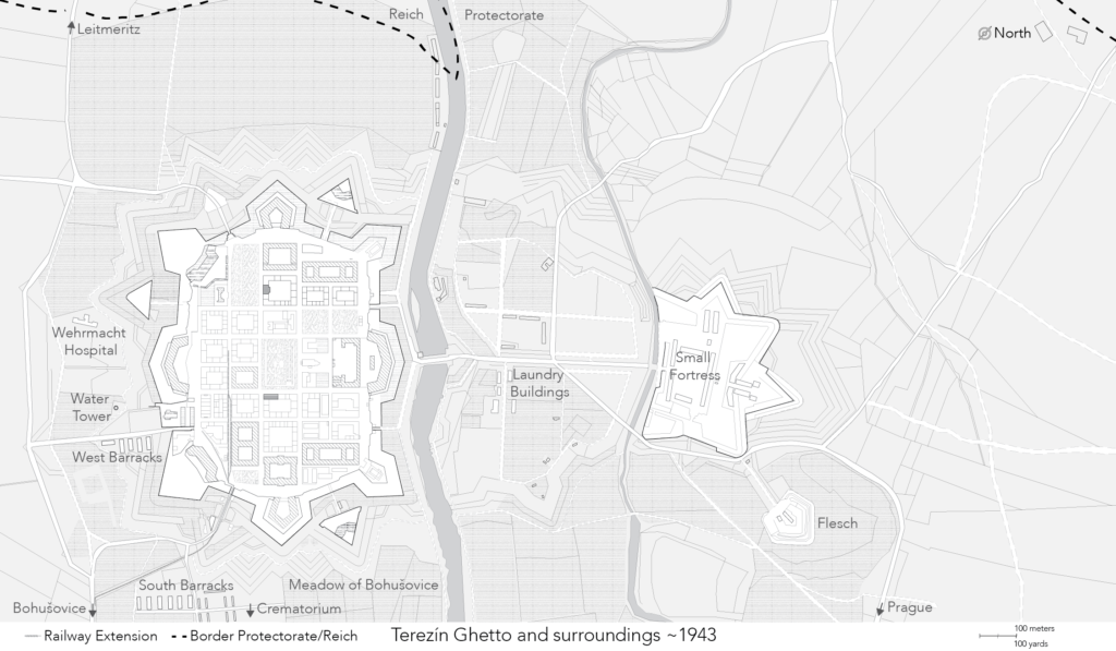
Map 2: Theresienstadt ghetto and surrounding, ca 1943. Horizontal hatches demark the area of Agriculture ran by the ghetto. Copyright Albane Duvillier. Based, among others, on “Wirtschaftsplan Theresienstadt,” Archive Terezín Memorial, with thanks to Tomáš Fedorovič; on historical maps from 1939-1941; and on feedback by Alice Kundrátová.